Difference between revisions of "File:Lake street satellite image 2003-12-01.jpg"
From universalworldchurch.org
Jump to navigationJump to search| Line 1: | Line 1: | ||
This is a satellite image of the former site (34.068289 N, -118.271176 W) of the Universal World Church, taken December 1, 2003. The site is the large green field in the center of the image. [[123 N. Lake Street | North Lake Street]] is to the right. Image: US Geological Survey. | This is a satellite image of the former site (34.068289 N, -118.271176 W) of the Universal World Church, taken December 1, 2003. The site is the large green field in the center of the image. [[123 N. Lake Street | North Lake Street]] is to the right. Image: US Geological Survey. | ||
| + | [[Category: Pictures of the Universal World Church]] | ||
| + | [[Category: Building Pictures]] | ||
| + | [[Category: Satellite Images]] | ||
Latest revision as of 17:46, 22 March 2011
This is a satellite image of the former site (34.068289 N, -118.271176 W) of the Universal World Church, taken December 1, 2003. The site is the large green field in the center of the image. North Lake Street is to the right. Image: US Geological Survey.
File history
Click on a date/time to view the file as it appeared at that time.
| Date/Time | Thumbnail | Dimensions | User | Comment | |
|---|---|---|---|---|---|
| current | 17:40, 16 March 2011 | 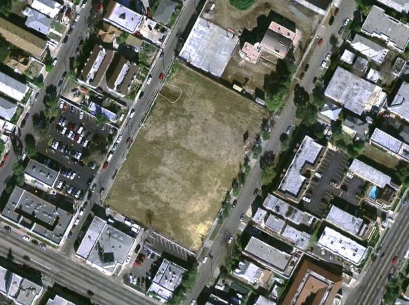 | 814 × 606 (245 KB) | Admin (talk | contribs) | This is a satellite image of the former site (34.068289 N, -118.271176 W) of the Universal World Church, taken December 1, 2003. The site is the large green field in the center of the image. North Lake Street is to the right. Image: US Geological Survey. |
You cannot overwrite this file.
File usage
There are no pages that use this file.